
Siri sin guide
Sightseeing
Do you want to experience a real fishing village, culture, good food mixed with fantastic nature then Henningsvær is a good place to visit to enjoy the atmosphere, lovely cafes and restaurants. You can also hike «Festvågtind», its a good hike with amazing view.
65 locals recommend
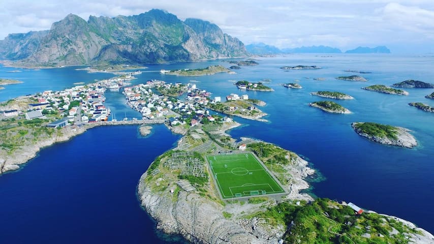
Henningsvær
Do you want to experience a real fishing village, culture, good food mixed with fantastic nature then Henningsvær is a good place to visit to enjoy the atmosphere, lovely cafes and restaurants. You can also hike «Festvågtind», its a good hike with amazing view.
Hike
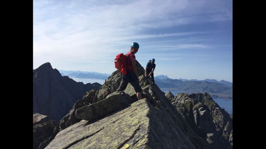
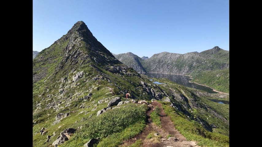
Festvågtinden in Lofoten (541 m above sea level)
Delicious, airy and easily accessible. Festvågtind is an excellent destination. Here, it goes up steeply from the first step. From the popular peak, you get a view of the fishing village of Henningsvær, and Lofotodden, which stretches boldly out into the sea.
Festvågtind is located on Austvågøy's southernmost point, three kilometers north of the fishing village of Henningsvær in Lofoten. The trip starts at the big turn the car road takes right at Festvåg. A small path starts between the bushes in the road ditch and continues along the stone stairs and the wall of the old water reservoir.
LEVEL OF DIFFICULTY
Steep, windy ride. Mostly on a good path, some splitting in stone piles.
STARTING PLACE
The water reservoir approx. 2 km north of Henningsvær
DURATION
About. 1.5 hours up
DISTANCE
about. 1.3 km
16 locals recommend
Festvagtind Hike
51 HenningsværveienFestvågtinden in Lofoten (541 m above sea level)
Delicious, airy and easily accessible. Festvågtind is an excellent destination. Here, it goes up steeply from the first step. From the popular peak, you get a view of the fishing village of Henningsvær, and Lofotodden, which stretches boldly out into the sea.
Festvågtind is located on Austvågøy's southernmost point, three kilometers north of the fishing village of Henningsvær in Lofoten. The trip starts at the big turn the car road takes right at Festvåg. A small path starts between the bushes in the road ditch and continues along the stone stairs and the wall of the old water reservoir.
LEVEL OF DIFFICULTY
Steep, windy ride. Mostly on a good path, some splitting in stone piles.
STARTING PLACE
The water reservoir approx. 2 km north of Henningsvær
DURATION
About. 1.5 hours up
DISTANCE
about. 1.3 km
This hike starts from right outside our house.
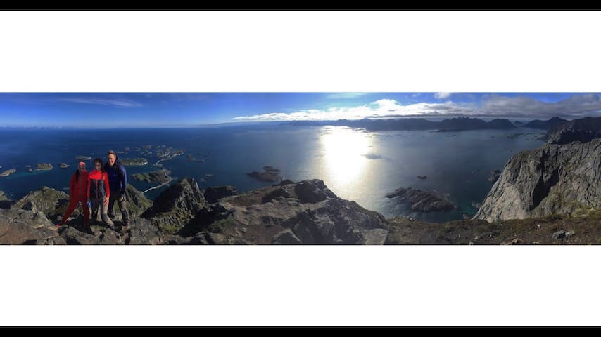
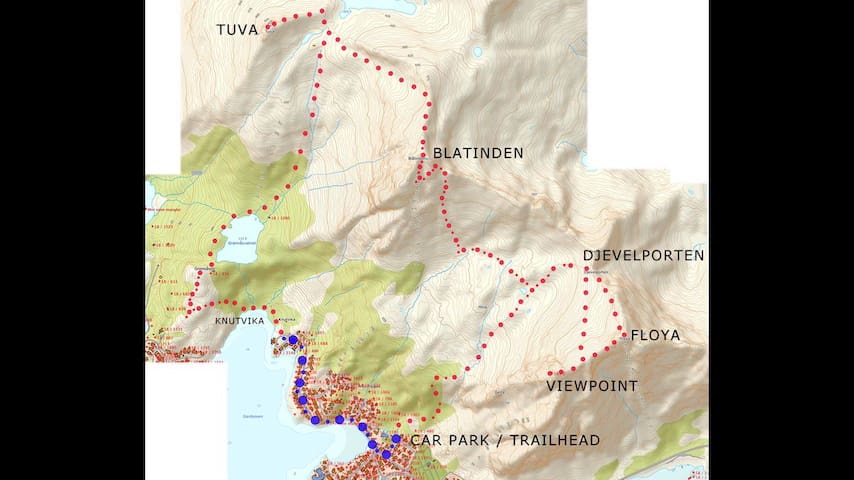
Length and duration 5.1 km 3 hours The trip goes round-trip the same way. Altimeter 493 meters in height in total. You can walk further to «Blåtind», «Djevelporten also called Devils gate», «Fløya» and «Svolværgeita also called the goat». Look at the map for several different hikes
A trip to Tuva (477 m.a.s.l.) gives you an impressive view of the distinctive combination of sea, islands and steep mountains that is so typical of Lofoten. The trip takes 3-4 hours round trip and goes along an occasionally steep path - but this is still a trip for the whole family. In winter, many people make the trip with their skis on their backs and stand down.
Follow the car road and stop next to the sign marked «Tuva/Blåtind». Follow the path approx. 500 metres, and then turn right towards Grønåsvatnet. Follow the north-west side of the water and then up towards Tuvavatnet. Then you turn left towards the top of Tuva, where a spectacular view awaits you.
Tuva
This hike starts from right outside our house.
Length and duration 5.1 km 3 hours The trip goes round-trip the same way. Altimeter 493 meters in height in total. You can walk further to «Blåtind», «Djevelporten also called Devils gate», «Fløya» and «Svolværgeita also called the goat». Look at the map for several different hikes
A trip to Tuva (477 m.a.s.l.) gives you an impressive view of the distinctive combination of sea, islands and steep mountains that is so typical of Lofoten. The trip takes 3-4 hours round trip and goes along an occasionally steep path - but this is still a trip for the whole family. In winter, many people make the trip with their skis on their backs and stand down.
Follow the car road and stop next to the sign marked «Tuva/Blåtind». Follow the path approx. 500 metres, and then turn right towards Grønåsvatnet. Follow the north-west side of the water and then up towards Tuvavatnet. Then you turn left towards the top of Tuva, where a spectacular view awaits you.
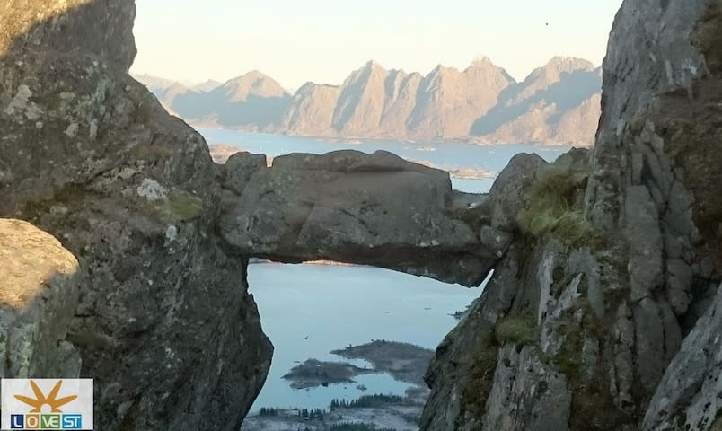
Djevelporten boulder
SvolværveienLook at the picture with several routes you can hike.
Vågakallen is a demanding hike for very experienced hikers. If you have the stamina, balance, experience and the required equipment, this is a great challenge with a view you're unlikely to forget anytime soon.
943 meters above sea
Level 9/10
Distanse 9 km
Time 6-10 hours depending on your stamina
The view on the way up and at the top is fantastic on sunny days. But the trip to Vågakallen should preferably not be carried out on days when it rains, as it can be slippery and because there are some drops on the last part. In other words, the trip is not a trip you should embark on if you are not completely comfortable with heights. It is also important to bring enough food and drink so that you do not run out of energy along the way, as this trip is both long and demanding.
Please note that the maps of the paths are intended to give an approximate description of where to go, they are not intended for exact positioning. You always have to judge for yourself where it is best to proceed based on what you see with your own eyes.
The trip to Vågakallen:
- Good paths for most of the trip, with some exceptions at the very beginning.
- Suitable for experienced and active hikers who are not afraid of heights.
- Requires good shoes with grip.
- Lofoten's fourth highest mountain peak and a well-known climbing area.
- Unbelievably great view over the Vestfjorden and the south side of Lofoten 25 minutes drive from Svolvær
13 locals recommend
Vågakallen
Vågakallen is a demanding hike for very experienced hikers. If you have the stamina, balance, experience and the required equipment, this is a great challenge with a view you're unlikely to forget anytime soon.
943 meters above sea
Level 9/10
Distanse 9 km
Time 6-10 hours depending on your stamina
The view on the way up and at the top is fantastic on sunny days. But the trip to Vågakallen should preferably not be carried out on days when it rains, as it can be slippery and because there are some drops on the last part. In other words, the trip is not a trip you should embark on if you are not completely comfortable with heights. It is also important to bring enough food and drink so that you do not run out of energy along the way, as this trip is both long and demanding.
Please note that the maps of the paths are intended to give an approximate description of where to go, they are not intended for exact positioning. You always have to judge for yourself where it is best to proceed based on what you see with your own eyes.
The trip to Vågakallen:
- Good paths for most of the trip, with some exceptions at the very beginning.
- Suitable for experienced and active hikers who are not afraid of heights.
- Requires good shoes with grip.
- Lofoten's fourth highest mountain peak and a well-known climbing area.
- Unbelievably great view over the Vestfjorden and the south side of Lofoten 25 minutes drive from Svolvær
You can hike both Kongstinden and Løva. Look at the picture/map. The green pin is Kongstinden and the red one is Løva.
Tour length 4h 30min
Distance 6.5 km
Altitude 843
Kongstindan
You can hike both Kongstinden and Løva. Look at the picture/map. The green pin is Kongstinden and the red one is Løva.
Tour length 4h 30min
Distance 6.5 km
Altitude 843
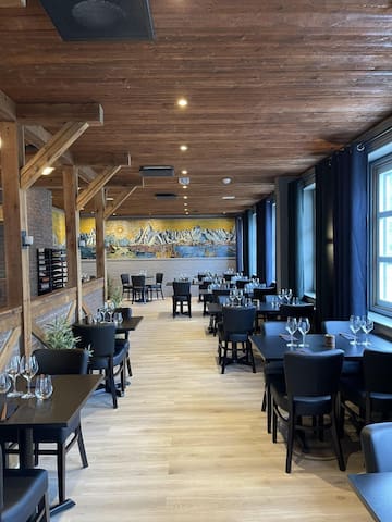
Matkultur
In our opinion the best food experience in Svolvær. All locally sourced ingredients artistically put together and paired with great wine. On the costly end of the spectrum but worth every penny
9 locals recommend
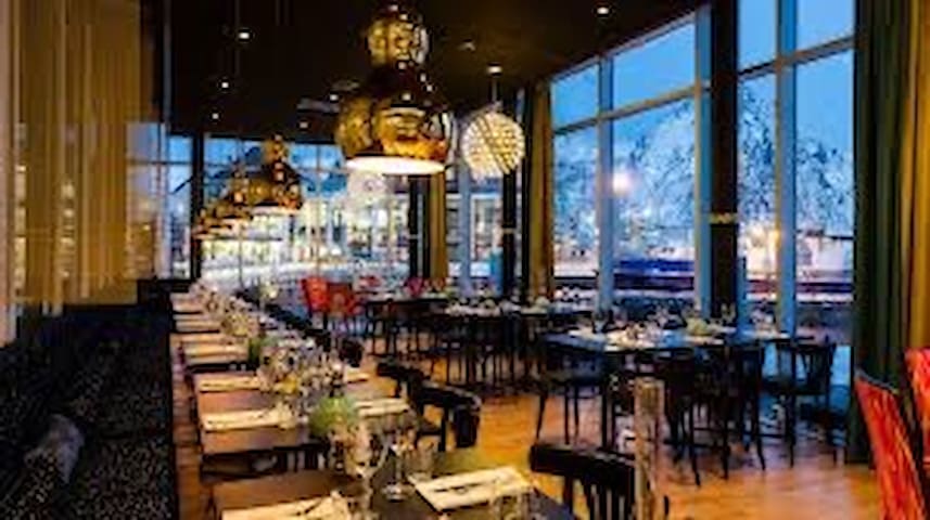
Paleo Arctic
TorgetIn our opinion the best food experience in Svolvær. All locally sourced ingredients artistically put together and paired with great wine. On the costly end of the spectrum but worth every penny
Restaurant Kjøkkenet
LamholmenGreat hearty food with a «home made» feel. Also a bit pricey.
Sakura Lofoten
2 O. J. Kaarbøs gateGREAT sushi! Also available as takeaway
Best medium budget restaurant option. Nice Chinese, friendly staff and quick service. Also available as takeaway
6 locals recommend
Restaurant Nihao
12B Joh. E. Paulsens gt.Best medium budget restaurant option. Nice Chinese, friendly staff and quick service. Also available as takeaway